MOUNT DEFIANCENEW YORK |
 |
| US4 | NY5 | US7 | US9W | US20 | US60 | US202 | US221 | Canal |
MOUNT DEFIANCENEW YORK |
|
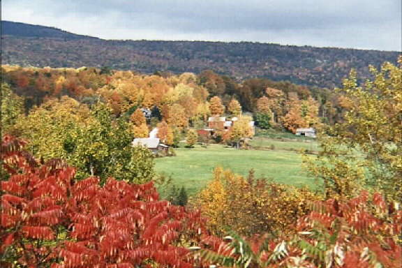
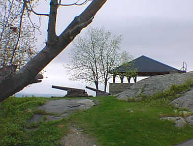
Mount Defiance is open during the day from spring to fall. There is a pavilion on the top with picnic tables and many historical markers.
The road to the top is the road that was cut by the British when they observed on July 2, 1777 that the American positions at Fort Ticonderoga and Mount Independence might be vulnerable from this mountaintop. On July 4th, the American forces began to panic when they saw the cannons being moved up the mountain. The retreat began in darkness on the evening of July 5th.
In September of 1777, it was America’s turn to put cannons on top of this mountain. Under the leadership of Colonel John Brown, cannons were placed and fired, however, the British forces did not panic, retreat or surrender. Actually, Brown found that fort was not an easy target from the mountain. The attempt to bombard Fort Ticonderoga from Mount Defiance was not successful and the British held the fort until the end of the war.
 |
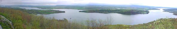
The Fort Ticonderoga peninsula reaches east towards Mount Independence on the Vermont shore to form a choke point. Here, two waterways from the south converge, flowing north to the Saint Lawrence River. Whoever controlled this passage controlled travel between New York and Nouvelle France (Canada). American troops connected the two fortified positions the winter of 1776-1777. East Creek, on the far side of Mount Independence, protected retreating American troops from a flanking German attack in July of 1777, allowing them to regroup and fight again at Hubbardton and Bennington. |
|
|
Enroute to Skenesboro (Today's Whitehall, NY)
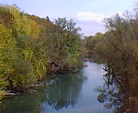
LaChute River Marker.
|
|
LaChute River Town of Ticonderoga French military engineers chose this strategic spot to build Fort Carillon to protect French Canada from the British because two water transportation routes from the south met here where the waters of Lake George meet those of Lake Champlain. The Mount Independence peninsula in Vermont nearly touches Ticonderoga point on the New York side. In the 19th Century, the LaChute River powered dozens of industries as its water fell 230 feet over a two mile course. Today a nature trail and scenic park provide access to the river. An extensive marsh behind the railroad causeway attracts many species of migratory birds in the Spring and Fall. |
|
|
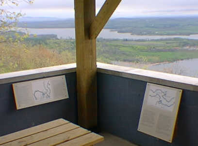
Champlain Valley Overlooks.