OLD FORT EDWARDNEW YORK |
 |
| US4 | NY5 | US7 | US9W | US20 | US60 | US202 | US221 | Canal |
OLD FORT EDWARDNEW YORK |
|
Just past the intersection with Route 197 is the Anvil Restaurant and Lounge. There are two markers near the restaurant. The first marker is out near Route 4. It indicates that this was the site of the North East Bastion of Old Fort Edward. The second marker, “The Great Carrying Place,” is actually inside the restaurant's fenced in area for outdoor eating.
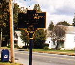 |
North East Bastion Part of the outworks of Fort Edward |
|
|
1755, The Great Carrying Place Fort Nicholson, Fort Lideous and Fort Lymon
|
You can reach additional markers by detouring off US Route 4 straight past the Anvil Restaurant toward the Hudson River and turning right on Old Fort Street. On the right, in the middle of a side yard of a neighborhood home is a moat marker. This little neighborhood happens to be in the middle of what used to be a big old fort.
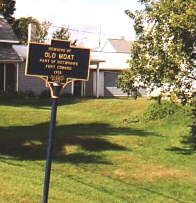 |
Remains of Old Moat Part of the outworks of Fort Edward |
A little further down the street is a dead end. You should see a very small park at the end of the street, but be warned, the property to the left of the park is posted. The owner often parks his truck in front of the park.
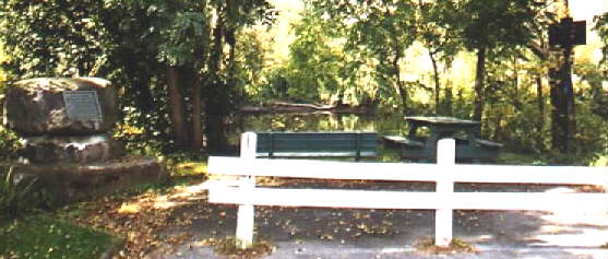
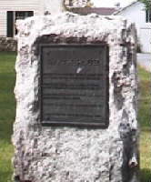
If you can find a place to park, there is a little park that overlooks a bend in the Hudson River. It is easy to see why a fort at this strategic position would easily control access to the Hudson River and thereby control the two routes to Lake Champlain. In the park is a boulder with a marker on it.
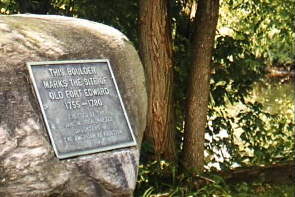 |
Fort Edward This boulder marks the site of old Fort Edward, 1755-1780. Erected by the Jane McCrea Chapter of the Daughters of the American Revolution in 1914. |
Since this is not a very wide road, turning around is a bit tricky. You might want to back down street.
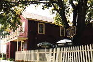
Just south of Old Fort Edward is the Old Fort House Gift Museum. It can be reached by returning back to US Route 4 and going south around a couple bends. There are several markers at the house.
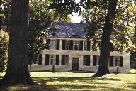 Old Fort
Edward is actually a part of the house. As the stone marker explains, timber
taken from the fort was used for building in 1767. Because this was done, the
old fort was in no condition for battle when Philip Schuyler inspected it in
1777. Consequently, the Americans had to find a place further south for their
stand against the British. If the fort was in better condition, the Americans
could have used the fort as a base of operations to split the British forces
from their supplies.
Old Fort
Edward is actually a part of the house. As the stone marker explains, timber
taken from the fort was used for building in 1767. Because this was done, the
old fort was in no condition for battle when Philip Schuyler inspected it in
1777. Consequently, the Americans had to find a place further south for their
stand against the British. If the fort was in better condition, the Americans
could have used the fort as a base of operations to split the British forces
from their supplies.
Actually, the marker should read: "Site of the North East Bastion of Fort Edwards". It is very clear that the North East Bastion no longer exists.
|
|
The Smythe House Erected by Patrick Smythe about 1767 of timber taken from Fort Edward. The first tavern and scene of the first court in Charlotte County. Headquarters of Schuyler, Arnold, Burgoyne, and Stark in 1777. It is the oldest house in Washington County. |
Enroute to Fort Miller
Jane McCrea Marker.
| Near this spot lies the body of Tobias Van Veghten, a lieutenant in Colonel McCrea's regiment killed at the Jane McCrea massacre, July 27, 1777. | 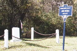 |
The Original Burial Place of Jane McCrea July 28, 1777. |